River Characteristics
Specification link
This page covers part of section 1.1.1 as well as 1.1.2 and 1.1.5 of the CIE O Level Geography specification.
1.1.1 - Characteristics of rivers the long profile, width, depth, speed of flow/velocity, discharge, wetted perimeter and channel
1.1.2 - The Bradshaw model.
1.1.5 - Processes which operate within a river:
erosion; hydraulic action, abrasion, attrition
solution, transportation; traction, suspension, saltation, solution
deposition.
Characteristics of river profiles
Characteristics of river profiles
River characteristics
All rivers have long and cross-profiles
Each river's long and cross profiles are unique, but they do have some characteristics in common
These profiles show changes in river characteristics from the source to the mouth
Long profile
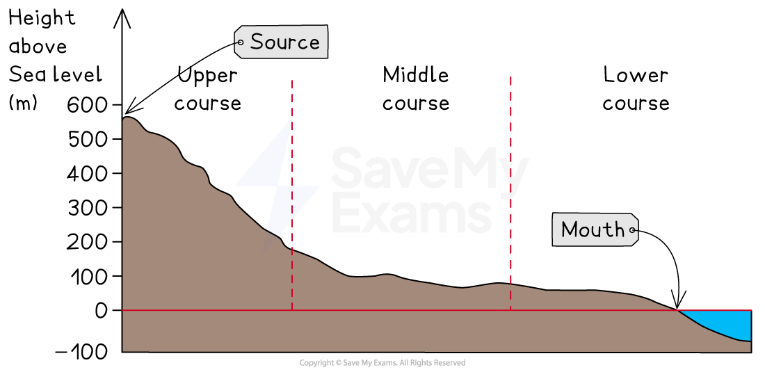
The long profile of a river shows the changes in the river gradient from the source to the mouth
Most long profiles have a concave shape with similar characteristics:
The source is usually in an upland area
The upper course of the river includes steep areas with uneven surfaces
In the middle course, the gradient decreases
In the lower section, the gradient decreases further until it becomes almost flat
Cross profiles
The cross profiles of a river are cross-sections from one bank to another
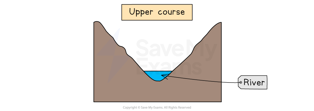
Cross profiles of the upper, middle and lower courses show the changes in the river channel
Upper course characteristics tend to include:
shallow
steep valley sides
narrow
low velocity
large bedload
rough channel bed
high levels of friction
vertical erosion
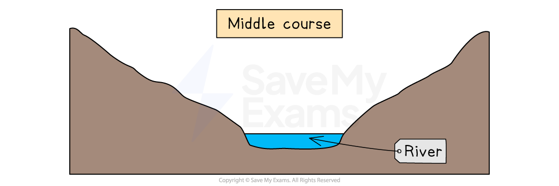
Middle course characteristics tend to be
deeper than upper course channel
gentle valley sides
wider than upper course channel
greater velocity than upper course channel
material in river decreases in size
smoother channel bed
lower levels of friction than upper course channel
lateral erosion
Lower course characteristics tend to be
deeper than middle course channel
flat floodplains
wider than middle course channel
greater velocity than the middle course channel (apart from as the river enters the mouth)
material carried mainly sediment and alluvium
smooth channel bed
lowest friction
deposition is dominant

The Bradshaw Model
The Bradshaw Model
As a result of erosion, transportation and deposition, the character of a river changes as it moves downstream as shown in the cross-profiles
These changes are summarised in the Bradshaw model
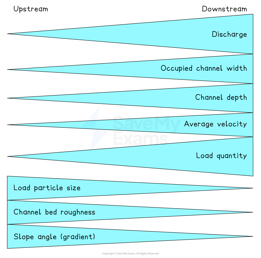
Bradshaw's model shows that the following characteristics increase with distance downstream (away from the source):
discharge
width
depth
velocity
load quantity
Other characteristics decrease:
load size
bed roughness
gradient (slope angle)
Wetted perimeter and hydraulic radius
The wetted perimeter is the length of the cross-sectional area where the water is in contact with the banks and bed
The efficiency of the river is measured using hydraulic radius (cross-sectional area divided by wetted perimeter)
The higher the ratio the greater efficiency and less friction
This increases the amount of erosion, which means the channel becomes wider and deeper
River processes
River processes
Erosion
Erosion is the wearing down of surfaces
There are four erosion processes that change the shape of the river channel:
Hydraulic action
The force of the water, which removes material from the bed and banks of the river
Abrasion
When the materials carried by the river scrape away the banks and bed
Attrition
When the material being carried by the river hits each other, the pieces become rounder and smaller
Corrosion (solution)
When rocks are dissolved in slightly acidic water
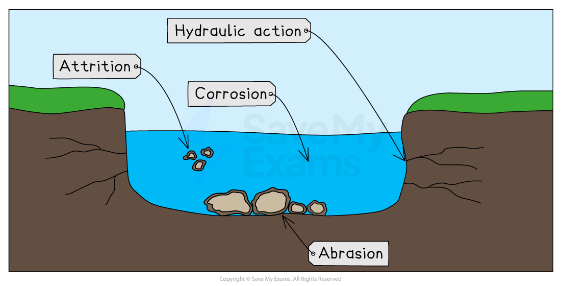
Erosion can be mainly vertical or lateral:
Vertical erosion is dominant in the upper course of rivers. It increases the depth of the river and valley as the river erodes downwards
Lateral erosion is dominant in the middle and lower courses of rivers. It increases the width of the river and valley as it erodes sideways
Transportation
There are four processes of transportation:
Traction
Occurs when larger rocks and materials are rolled along the riverbed
Saltation
Smaller material, which can be lifted by the water, bounces along the riverbed
Suspension
Lighter material carried within the river flow
Solution
When materials are dissolved in the river water
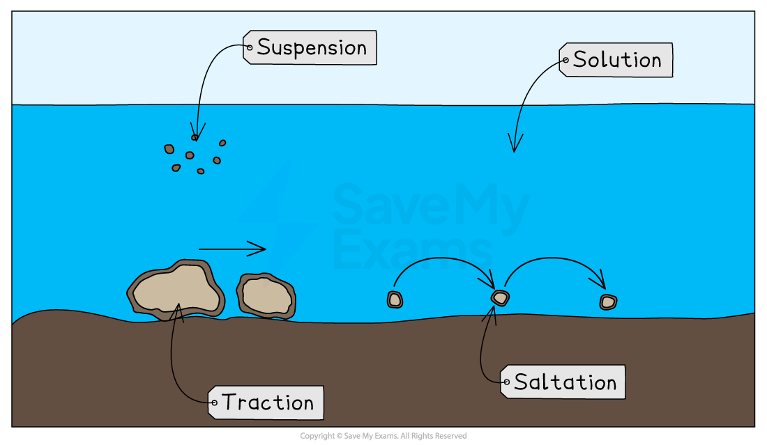
a
Deposition
When a river does not have enough energy to carry materials, it drops them
This is deposition
The causes of reduced energy include
Reduced discharge due to a lack of precipitation or abstraction upstream
Decreased gradient
Slower flow on the inside of a river bend or where the river is shallower
When the river enters a sea, ocean or lake
The heaviest material is deposited first; this is known as the bedload
The lighter materials, gravel, sand and silt, are known as alluvium and they are carried further downstream
The dissolved materials are carried out to sea