Geographic Information Systems (GIS)
Using GIS
Using GIS
Geographic Information Systems (GIS) is digital software which analyses and displays data on maps
Each GIS map is made of layers, each of which shows different information
The maps can then be used to:
Identify correlations and patterns
Assist in:
Urban planning
Disaster management
Environmental conservation
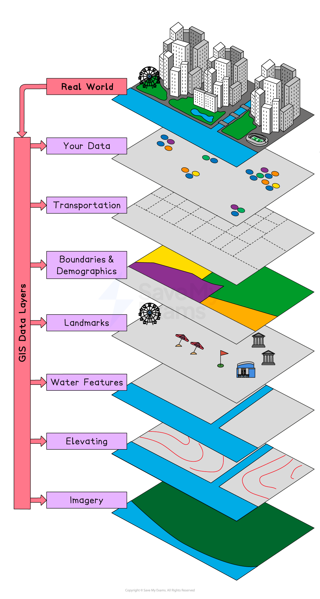
Using GIS software, users can:
Zoom in and out to different scales
Turn layers of information on and off
Add data
The complexity of GIS maps depends on the purpose of the map
Google Maps is an example of a GIS application
Within fieldwork enquiries, GIS can be used either:
To display primary data
As a source of secondary data
Benefits & Limitations of GIS
Benefits & Limitations of GIS
Benefits of GIS
GIS applications are used by businesses and governments
The use of GIS has several benefits, including:
Improved decision-making because they clearly show patterns and relationships between different sets of information
Effective planning for example when making decisions about where to place new housing or an industrial estate
Market analysis to make decisions such as where to put a new supermarket
Disaster preparedness and response by examining the areas most at risk
Limitations of GIS
GIS can be expensive
Inputting the data required can be time consuming
Quality GIS output depends on quality data being inputted, which includes:
The accuracy of data
Whether the data is up to date
Consistency between types of data
Bias when using GIS is also an issue because:
Many maps still use the Mercator projection, which distorts the size of countries and regions
The information shown depends on what is selected by the user