2.2.4 River Landforms
River Landforms
River Landforms
River landscape characteristics
The changes in river channel characteristics, lead to changes in the river landscape
The upland and lowland areas of rivers have distinctive landforms
Upland:
Waterfalls
Gorges
V-shaped valleys
Interlocking spurs
Waterfalls and gorges
Waterfalls form where there is a drop in the river bed from one level to another
This drop is often due to changes in the hardness of the rock, where hard rock overlies soft rock
Hydraulic action and abrasion are the main erosional processes:
The soft rock erodes quicker, undercutting the hard rock and creating a plunge pool
This leads to the development of an overhang of hard rock which eventually over time, collapses
The overhang falls into the plunge pool increasing abrasion and making the plunge pool deeper
The process then begins again and the waterfall retreats upstream leaving a steep sided gorge
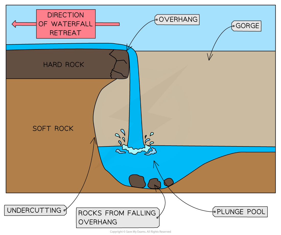
Waterfall Formation
V-shaped valleys
Vertical erosion is dominant in the upper course of the river
This cuts down into the river bed and deepens the river channel
Weathering and mass movement leads to material from the valley sides collapsing into the river forming a steep v-shaped valley
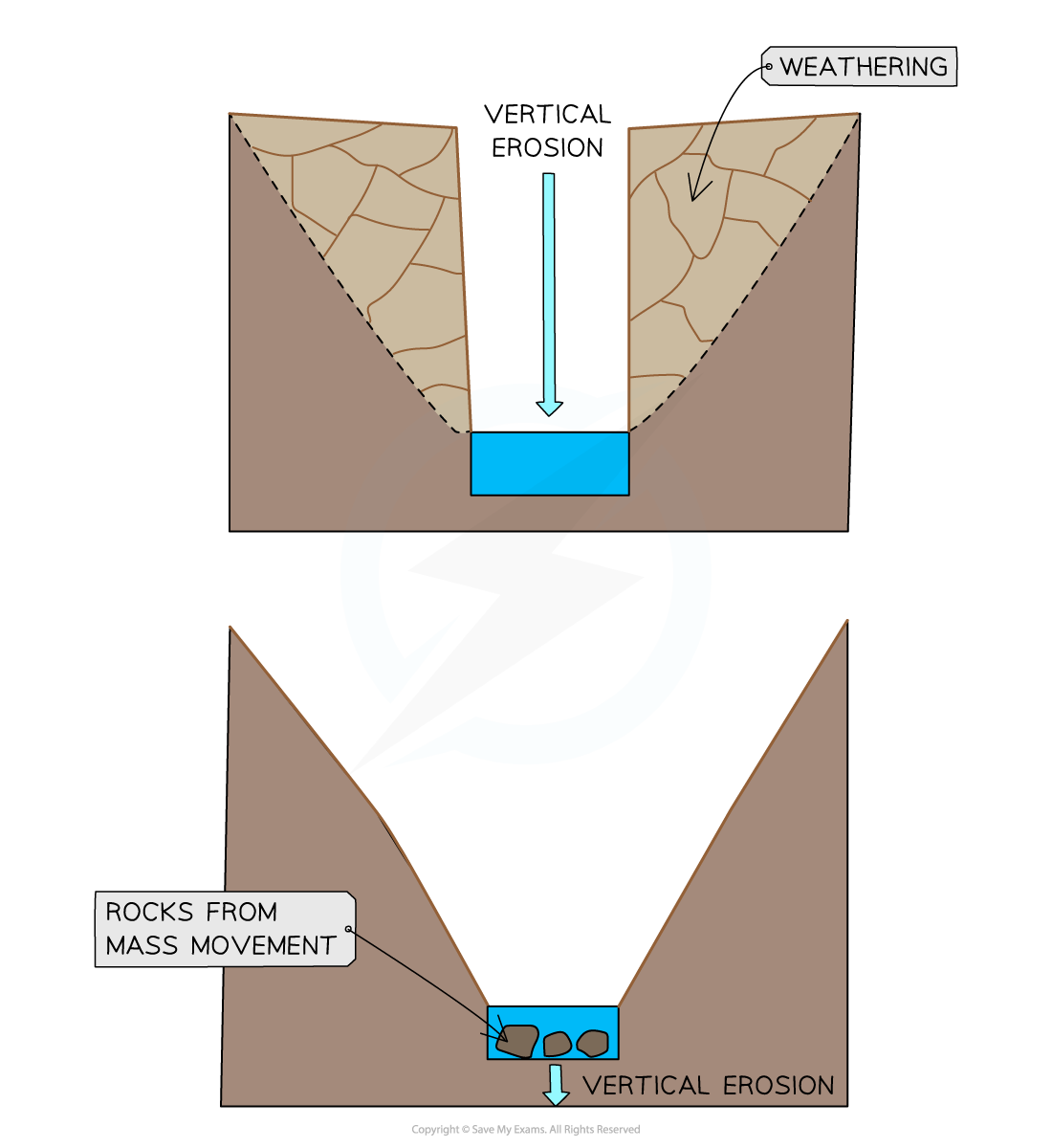
Formation of a V-Shaped Valley
Interlocking spurs
In the upper course of the river the channel starts to meander
Erosion happens on the outside of the bend
In the upland areas this forms interlocking spurs
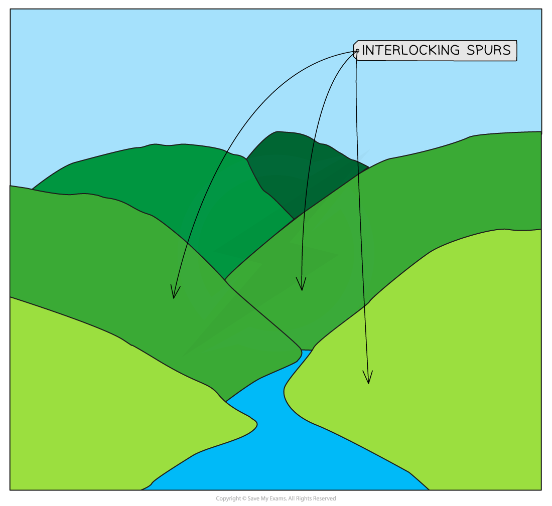
Interlocking Spurs
Lowland features:
Meanders
Ox-bow lakes
Floodplains
Levees
Meanders
In lowland areas lateral erosion is dominant
Meanders increase in size
The fastest water flow (thalweg) is on the outside of the river bends, leading to erosion:
The erosion undercuts the riverbank forming a river cliff
The riverbank collapses and the edge of the meander moves further out
The slowest flow is on the inside of the river bends, leading to deposition:
The deposits form a slip-off slope
Deposition on one side and erosion on the other leads to the meander migrating across the valley

Cross-section of a Meander
Oxbow lakes
With distance downstream the size of the meanders increase
The erosion on outside bends can eventually lead to the formation of a meander neck
At a time of the flood, the river may cut through the neck of the meander forming a straighter course for the water
The flow of water at entry and exit from the meander will be slower, leading to deposition
The meander becomes cut off from the main river channel, forming an oxbow lake
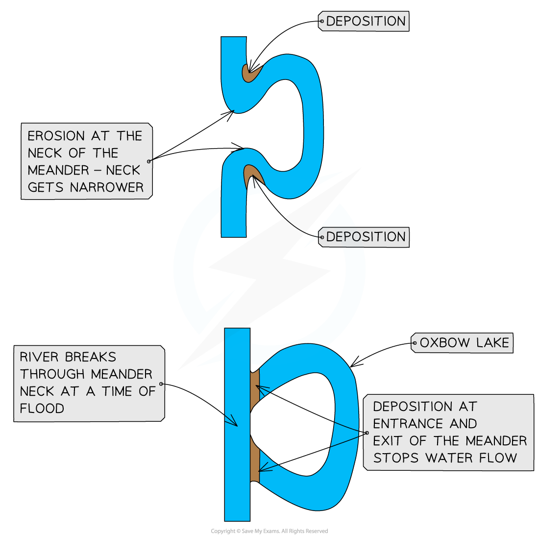
Oxbow Lake Formation
Floodplains and levees
Floodplains are flat expanses of land either side of the river
The migration of meanders leads to the formation of the floodplain
High discharge may cause the river to overflow the banks
More of the water is in contact with the land surface as the water spreads across the floodplain
Increased friction reduces velocity and material is deposited across the floodplain gradually increasing the floodplain height
The heaviest material is deposited first nearest to the river channel forming natural embankments called levees
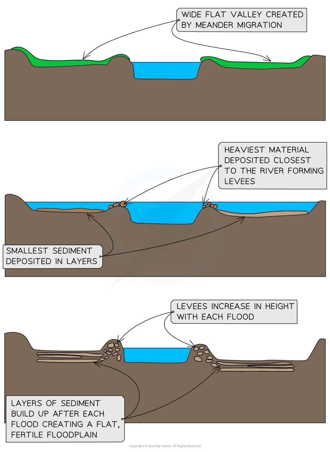
Levee and Floodplain Formation